Activities
Plan a Saturday hike, a weekend float, a fall elk camp. RSVPs, gear lists, and meeting points — without another group chat.
An app for hikers, riders, paddlers, and climbers who are done scrolling strangers. Groups, Activities, Maps, and offline-capable AI — built around the people you actually go outside with.
Get Early AccessBuilt in Utah · iOS 17+ · Android coming
Your feed is the people you actually go outside with. Not strangers gaming an algorithm. Just yesterday's sunrise from the ridge and the trout your brother finally landed.
See it live →Organize rides, hunts, paddles, and sunrise missions with the humans who actually show up. Groups keep the chatter in one place; Activities turn "we should" into "we're meeting at 5am."
Rally your crew →Every screen in Nomatic Atlas is built around one idea — the outdoors is better with your people. The point of the app is to get you off the app. Just the tools you actually need, wrapped in a community that shows up.
Plan a Saturday hike, a weekend float, a fall elk camp. RSVPs, gear lists, and meeting points — without another group chat.
Real circles, not crowds. Private DMs, shared calendars, and live channels for your hunt camp, your ski crew, your van club.
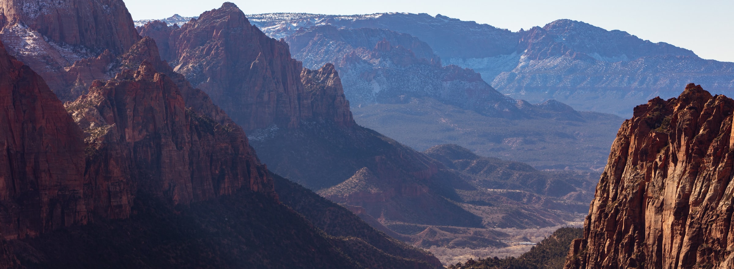
Detailed topo cached on your phone before you lose signal. Layers for hunting, fishing, hiking, photography — flip on what matters, hide what doesn't.
On-device AI for the outdoors. Ask about trails, weather, gear, fish — it answers offline and keeps your data on your phone.
Detailed topo maps for every state, cached on your phone before you lose signal. On-device AI — Trailhead — answers questions about trails, weather, gear, and fishing reports without sending a byte to the cloud.
Request early access →Pick your mode, flip the layers that matter. Trails for every state, waterways down to the tributary, park boundaries and public-land lines — on or off with a tap.
Swipe to flip layers →
We sweat the small stuff — typography, color, timing, haptics. Every surface earns its place on your home screen.
What you'll never see in Nomatic Atlas. Pinned here so you can hold us to it.
We don't sell your personal data. Not to advertisers. Not to anyone.
No bots. No boosts. No engagement tricks.
The AI runs on-device. Your data stays on your phone.
The point of the app is to get you off the app.
The stuff people actually ask. If yours isn't here, hit reply on the welcome email.
We're rolling out TestFlight invites to the founding 500 first, then a wider beta, then App Store launch. We'll send you the invite the same day the build's ready — no roadmap pressure, no fake countdowns.
The founding-beta is free. Long term we plan a free tier and an ad-free paid tier. Final pricing gets decided by watching how the beta crew actually uses the app, not by guessing in a spreadsheet — and your data stays yours either way.
Eventually, yes — on the free tier. The paid tier will be ad-free. We're telling you now so it's not a surprise later. Ads will land where they make sense, not in the middle of someone's sunrise photo, and we won't sell your personal data to advertisers — those are two different things and we're keeping them separate.
After the iOS beta is solid. We'd rather ship one platform that works than two that don't. If you're on Android and want the heads-up, drop your email above — same waitlist gets the cross-platform invite when it's ready.
AllTrails is a trail database. Strava is a fitness tracker. onX is a hunting tool. Nomatic Atlas is the place you go between trips — to plan with the people you actually go outside with, share the photos no algorithm needs to rank, and get answers from an AI that doesn't need cell service. We're not trying to replace any one of them. We're trying to be the group chat that goes outside.
Trailhead, the AI assistant, runs on your phone — not in a data center. You can ask it about trails, weather, gear, and fishing reports without sending a byte to the cloud, which means it works in canyons, on ridgelines, and anywhere your bars don't. Your questions don't get logged or sold.
No. We don't sell your location, messages, photos, or email. We don't share data with third parties beyond what's needed to run the service. The Promise section above lists exactly what we won't do — pinned there so you can hold us to it.
Drop your email for a TestFlight invite. We send one note when the build ships — nothing else.
iOS 17+ · Android coming · built in Utah · no spam, ever